Chapter Two
Mormon Mountains Wilderness: there but no one can see
My love, my love,
We are endangered
Totally at last. Look
Anywhere to the sight’s limit: space
Which is viviparous:
Place of the mind
And eye. Which can destroy us,
Re-arrange itself, assert
Its own stone chain reaction.
-
Time of the Missile - George Oppen, 1962
On December 21, 1968, The National Aeronautics and Space Administration (NASA) launched Apollo 8 from Seminole, Ais, Miccosukee, and Mascogo land. This mission was a part of the Cold War Space Race between U.S. capitalists and U.S.S.R. communists (both with the help of Nazi scientists). It also let the world experience visually for the first time through an aerial photograph the previously invisible fact that we are on a globe in space. It was at this same time Walter De Maria and Michael Heizer began treating the earth's surface like a drawing and sculpting material and taking photographs of their Modern Desert Markings from the air. Walter De Maria even addressed the Earth's newly-known invisible object-ness by burrowing a kilometer long rod straight into the ground (with the help of a Texas oil company) in Germany in 1977.
I read about this relationship between these land artists and Cold War images of the Blue Marble in an essay about De Maria, not in any of the artist's words. But then De Maria once said, “Any artist who explains his work is a fool.” So, he was purposefully close-mouthed about his work. That said, Heizer has openly spoken about the relationship between his work and another ColdWar project––nuclear weapons testing. And of De Maria's few archived words he has praised natural disasters, repeatedly worked near nuclear weapons test sites, and has called art a matter "of life and death"––saying art works when it causes you to "lose your breath...lie down and die."
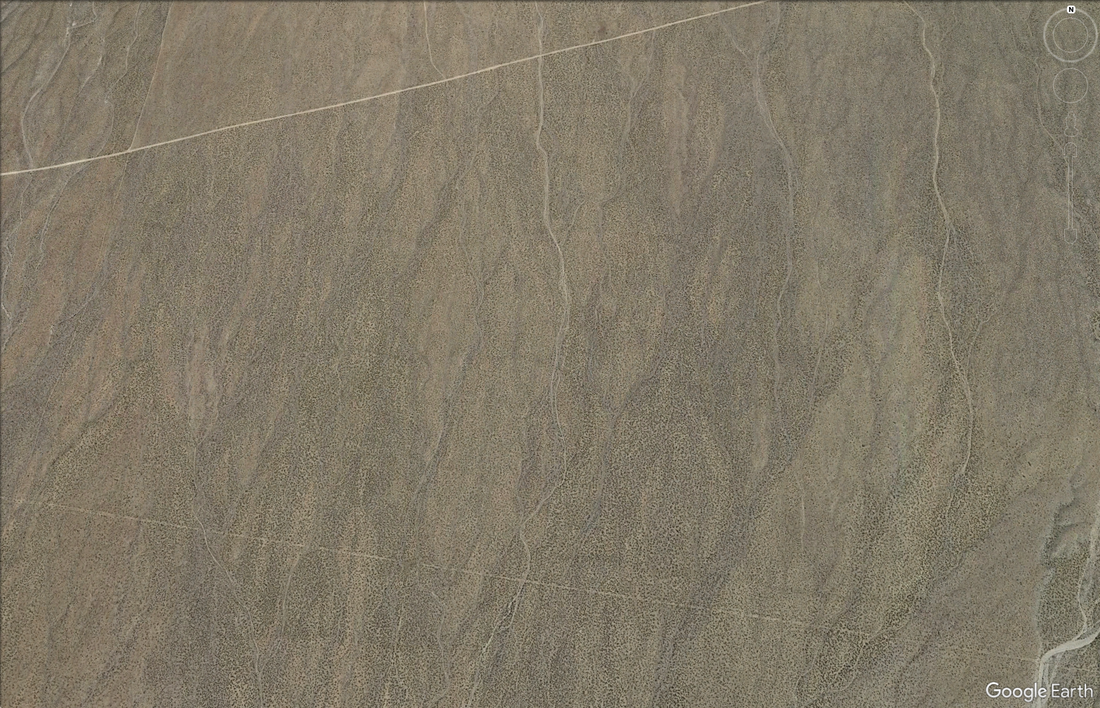
From these words I feel comfortable guessing that De Maria and Heizer would consider the field of craters created through nuclear weapons testing a work of LandArt. Especially if presented as a screenshot taken from Google Earth as this digital image binds two Cold War technologies. Yucca Flat as a landscape created through Cold War "Doomsday" technology. And Google Earth as Cold War espionage technology. The All-Seeing Eye and The Apocalypse.
The Bomb
“I think both art and life are matters of life and death.”
-
Walter De Maria
“The H-bomb, that’s the ultimate sculpture”
-
Michael Heizer
If you actually aren't carried away, if you actually aren't physically moved and you know, like...fearing for your life and sanity...Like, if you actually don't lose your breath, if you don't lie down and die, if you actually aren't run out of the place, you know, if your heart rate doesn't go up, if you actually don't lose your breath...if it doesn't match any very important massive, powerful experience you've had in your life, then it isn't a real work.
-
Walter De Maria, 1972
“Part of my art is based on an awareness that we live in a
nuclear era. We’re probably living at the end of civilization.”
-
Michael Heizer
“I like natural disasters and I think they might be
the highest form of art possible to experience.”
-
Walter De Maria
"There is nothing there, yet it is still a sculpture."
-
Michael Heizer
Even though the Utah War was over by April 1858, the fight between the federal government and Mormons went on for another 4 decades. This fight, mostly about Mormon immigration, political dominance in the West, and their polygyny practice, would most take place in congress and the courts. It wasn't until the Cold War that the U.S. would again militarily attack Mormons.
Ninety-six years after my military fort-building ancestor raised his stars and stripes over this Nuwu land the U.S. began dropping nuclear bombs down onto it. Thirty-seven years after that one of his grand-niece-in-laws, my Grandma, died of breast cancer in Goshute and Timpanogos land caused by nuclear weapons testing on Nuwu and Shoshone land. She wasn't alone. Between 340,000 and 690,000 people in the United States were killed by the U.S.'s testing of atomic weapons in the Nevada National Security Site.
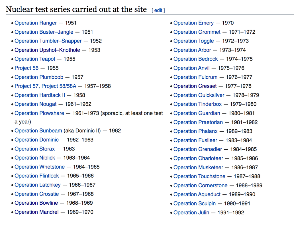
From 1951 to 1992 the U.S. detonated 1,021 nuclear explosives at the Nevada National Security Site (a.k.a. Nevada Test Site) which sits directly upwind of Nuwu lands predominantly occupied by Mormons in southwestern Utah. The U.S. government knowingly poisoned and killed hundreds of thousands of U.S. citizens and Indigenous persons (and hundreds of thousands more animals) and lied about it. Then they made propaganda films to reiterate their lies. And then lied some more about the safety of nuclear testing in court. All in the name of the preservation of the United States.
The Nevada National Security Site: The sum of the facts does not constitute the work or determine its esthetics
The United States has been bombed by more nuclear weapons than any other nation in the world.
The U.S. detonated nearly all of these bombs.
The first four places the U.S. bombed with nuclear weapons are Trinity Site, Japan, Bikini Atoll, and the Nevada Proving Grounds / Nevada National Security Site.
The U.S detonated at least 1,047 nuclear devices. 1,021 of those were detonated in Nuwu and Newe lands at the Nevada National Security Site.
The Nevada National Security Site (NNSS), is a United States Department of Energy (DOE) reservation located in southeastern Nye County, Nevada, about 65 miles northwest of the city of Las Vegas.
The land the NNSS occupies has also been known as the Nevada Test Site (NTS), Nevada Proving Grounds (NPG), Site Mercury, Las Vegas Bombing and Gunnery Range (LVBGR), Tonopah Gunnery and Bombing Range (TGBR), Desert Game Range, and Nuwu and Newe home/land.
The United States Atomic Energy Commission (AEC) was warned against testing nuclear weapons within the lands occupied by the continental United States by the Armed Forces Special Weapons Project. The AEC felt justified in doing so anyway at the beginning of the Korean War. They claimed this war threatened their Bikini Atoll testing site in the Pacific Ocean and so sought a national sacrifice zone within the continental United States.
The AEC and Department of Defense surveyed six sites in Alaska, Nevada, New Mexico, North Carolina, Texas and Utah before choosing the LVBGR.
Three sites were short-listed: White Sands Missile Range in Piro, Pueblo, and Mescalero Apache lands occupied by south-central New Mexico, the Dugway Proving Grounds in Goshute and Timpanogos lands occupied by western Utah, and two areas in Newe, Nuwu, and Nüümü lands occupied by Nevada.
The land is not the setting for the work but a part of the work.
The AEC picked the NNSS for its isolation, favorable meteorological conditions, distance from densely populated areas, and proximity to Las Vegas and operational facilities.
On December 18, 1950, President Harry Truman, the AEC and the Air Force signed an agreement to allow nuclear weapons testing on the Las Vegas Bombing and Gunnery Range.
On January 11, 1951, a flier printed with red type was posted around the test site stating "from this day forward the U.S. Atomic Energy Commission has authorized to use part of the Las Vegas Bombing and Gunnery Range for test work necessary to the atomic weapons development program,”–that nuclear detonations would be "carried out under controlled conditions," and that "no public announcement of the time of any test will be made."
Beginning January 27, 1951 the United States government conducted 100 above ground nuclear weapons detonations at the NTS.
The first atomic detonation at the NTS was code named Able. The first son of The Bible character Adam was named Able.
On May 19, 1953, at 5:05 a.m. on Yucca Flat, a four-ton atomic bomb code named Harry was detonated as part of the nuclear test series code named Upshot-Knothole
Harry was the 30th atmospheric detonation at the NPG.
Harry was detonated on top of a 300-foot tower and sent 1,734 tons of radiative earth into the air. Wind carried this mushroom cloud east to Shivwits Nuwu land and the Mormon settlement St. George, Utah.
An estimated 16,200 people were irradiated in the immediate area.
Harry brought as much ionizing radiation to St. George as the Chernobyl disaster brought to Pripyat, Ukraine.
AEC officials claimed that Harry’s fallout was "well within the limits of safety,” comparable to getting an x-ray.
Harry's irradiated cloud arrived in St. George, Utah in Shivwits land at 8:50 a.m.
As the cloud traveled it poisoned backyard vegetable gardens, community drinking water, and grazing pasture. Humans and their food animals consumed these irradiated nutrients and were poisoned. This radiation was also consumed in cow and human milk as Iodine-131 of which children were the main consumer.
In April 1955 the AEC produced “Atomic Tests in Nevada,” to reiterate their claim that atomic weapons testing, including Harry, was safe.
This propaganda film featured many St. George residents. Two-thirds of them died of cancer.
Secret AEC studies had already confirmed the harmful effects of radioactive fallout on livestock and other animals.
When the Upshot-Knothole series began, an estimated 11,710 sheep were grazing across Lincoln County, Nevada and western Utah.
By June 1953, 4,390 sheep had died in the greater St. George area, including 1,420 lambing ewes and 2,970 lambs. Ranchers were not notified of the cause of and many of these irradiated sheep were sold as food and wool.
The AEC stated that there was "no causal connection between the sheep's exposure to radioactive fallout emitted during the Upshot-Knothole test series and their deaths."
Harry was only one of 100 atmospheric nuclear weapons detonations at the NTS.
“It’s been estimated that 12 billion curies of radiation* were released during atmospheric testing conducted between 1951 and 1963 at the NTS.”
The invisible is real.
“Atmospheric testing occurring between 1951 to 1958 at the NTS likely contributed to 186,500 crude deaths and 63,500 cancer deaths in the twenty-year window after testing began.”
A significant excess of leukemia deaths occurred in children living in Utah between 1959 and 1967. This excess was most pronounced in those residing in counties receiving high fallout and in children born between 1951 and 1958.
In 1988, my mom’s mom became one of those 63,500 deaths when she died of breast cancer caused by nuclear testing.
On August 5, 1963 the United States, the United Kingdom and the Soviet Union signed a Partial Nuclear Test Ban Treaty.
Underground testing continued uninterrupted with 921 underground atomic weapons tests detonated until 1992. The Department of Energy decided to abandon the program entirely in 1996 under the Comprehensive Nuclear Test Ban Treaty.
110 atomic bombs were detonated at the NTS in my lifetime.
My grandma, my mom, and I all grew up about 250 miles away from Ground Zero.
Between 340,000 and 690,000 people were killed by atomic weapons testing in the Nevada National Security Site.
Isolation is the essence of Land Art.
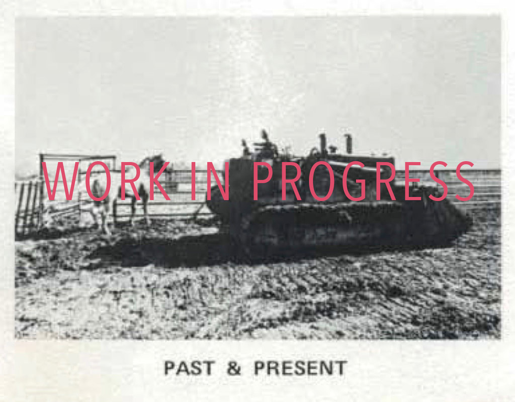
The Bulldozer
"Thus while in plain sight, they remained invisible.”
-
Walter De Maria, 1972
Eighteen-years after Mormon Pioneers raised a U.S. flag over these Nuwu lands––the U.S. began to force Moapa Nuwu onto a 39,000 square mile reservation. Two years later the reservation was reduced to only 1,000 acres. This was “followed by 60 years of neglect and corruption by white agents.”
Ninety-six years after Nuwu were forced onto reservations De Maria and Heizer were bombing and bulldozing Nuwu lands carving their Modern Desert Marks. Like my Mormon empire building ancestors, these settler land artists treated this Nuwu land as a terra nullic blank canvas. In fact terra nullius––a land with no history, a land with no People, a nulliparous, pristine, virgin wilderness––is what ties Manifest Destiny, to LandArt, to U.S. conservation. Each depends on empty lands created through the erasure of Indigenous Peoples and their histories.
My ancestors, the U.S. military, and modern land artists wanted to be far away from the densely populated eastern U.S. They sought a place of isolation in which they could realize their large scale visions. This required cheap land on which they could operate with little regulation. (Walter De Maria didn't even seek permission to make his Las Vegas Piece, he just pioneered his way through it.) Which meant finding land that "no one else wanted." Which required settler colonial Indigenous erasure.
So it is that even as Land Artists sought to subvert the restrictive capitalist framework of the art gallery by making their work inaccessible to the gallery––they end up furthering the capitalist U.S. settler-colonial project by further commodifying and mythologizing the colonial construct of The West through the erasure of Indigenous Peoples from their lands.
Las Vegas Piece: The sum of the facts does not constitute the work or determine its esthetics.
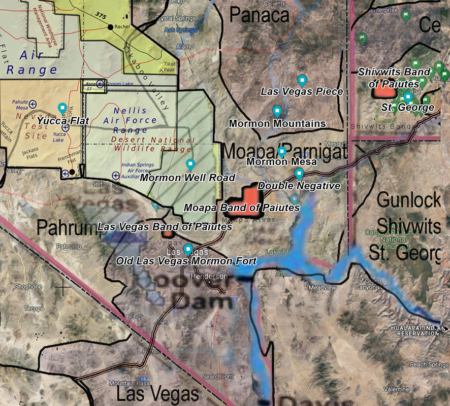
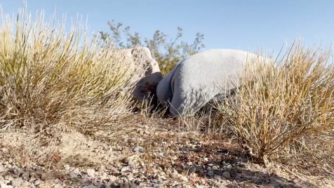
Las Vegas Piece is located about 100 miles from Las Vegas, below the Mormon Mountain Range, in the Tule Desert, in southeastern Nevada, in the Mojave Desert, on Nuwu lands.
The sculpture was completed in its physical form in 1969.
Desirable qualities of the location included isolation, flatness, proximity to Las Vegas, and the ability to work without permission or regulation.
Las Vegas Piece began in 1967 as a part of the conceptual piece, Three Continent Project, which was meant to made up of a “mile long line in the Sahara, a mile long line in India, a mile square in the United States.” De Maria eventually abandoned that Project and made this Piece instead.
The land is not the setting for the work but a part of the work.
Las Vegas Piece measures “about three miles.”
It is is composed of two one-mile long lines that extend away from each other at a 90 degree angle and two half-mile lines that extend from the mid-points of each of the one mile lines at 90 degree angle. These two shorter lines meet at a 90 degree angle.
Together, these four lines form “a perfect square measuring one-half mile on each side, with the northernmost and westernmost lines extending in a straight line one half mile beyond the bounds of the square.”
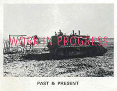
The “two feet deep and about eight feet wide” lines were “cut into the desert,” “cut with a bulldozer.”
All the lines run either east-west or north-south.
“You have a choice of walking east or west. If you walk east, you hit a dead end, if you walk west, you hit another road, at another point you hit another line. You actually have a choice—at that point you decide which way to go and so forth, then you continue, you walk another mile and at another point you walk another half mile and at a certain point you have to double back.”
“It takes two or three hours to drive from Las Vegas to Las Vegas Piece. It takes 20 minutes to walk from the road to the sculpture. It takes about four hours to walk all of the three miles of the thing. It takes about two hours to go back to Las Vegas.”
“You have to spend eight hours with this piece, at least four hours with it immediately, although to some extent the entrance and the exit is part of the experience of the piece.”
The primary experience of Las Vegas Piece is durational, is about “the notion of experiencing the desert, experience this sculpture”
“The experience of the work is extensive in both spatial and temporal terms. It is one of miles and hours, or even days.
The invisible is real.
De Maria never found “a way to photograph it” as a satellite image is “a different experience because that's an experience like a drawing but (Las Vegas Piece) is an experience at ground level.”
The work is located just outside of an Area of Critical Concern for the Desert Tortoise.
The Desert Tortoise has lived in the area that is now the Mojave Desert since the Pleistocene.
Today the Desert Tortoise is listed by the International Union for the Conservation of Nature as "Critically Endangered."
By 1984 colonization killed 90% of Desert Tortoise population.* By 1990 the Desert Tortoise was listed as "Threatened" under the Endangered Species Act. Despite this Tortoises continued to be killed off, losing another 32% of their overall population by 2004.
Major threats to Desert Tortoises include urbanization, military land use, livestock grazing, land use for energy production, and off-highway vehicle use, like bulldozers.
Desert Tortoises spend much of their time underground. Because of this they are often crushed by vehicles driving off of the road.
Walter De Maria described the area saying, “there (was) nothing in this valley except a cattle corral somewhere in the back.”
Isolation is the essence of Land Art.
The Land
“I find that the land is almost non-existent in Europe, I mean land is held within a family for hundreds of years, every square inch has been walked on, every square inch is known, who owns it, and so the idea of trying to pick up some empty land or even farm land is very expensive. And it's not even for sale; there isn't even land for sale in Europe. So that basically I was at a dead end and I would have to return to the west.”
-
Walter De Maria, 1972
“The Nuwu have maintained the unbreakable link between the land, animals and people through the inheritance of territorial songs…Songs were one of the primary means through which ownership of land and resources were recognized…The men who own the song own the mountain and land with which they are associated.”
-
Greg Anderson, former Chairman of the Moapa Band of Paiutes, 2018
In the quote above De Maria betrays his settler colonial ignorance as he describes Europe as a place of deep land-and-family-based histories, yet considers "the west" as a place of "empty land." For Nuwu, "every square inch" of their land is known through song. Their land holds this deep sense of history that we European-descendants acknowledge in Europe. But for colonial-minded folks, history on this continent began a few centuries ago when Columbus imported it. So, because founding colonists invisibilized Indigenous Peoples physically through genocide and conceptually through constructs like Terra Nullius and virgin wilderness, modern settler-colonists like Walter De Maria are able to unthinkingly make work in the so-called West like it is an "empty land" with no history but settler-colonial history--like its Pure Dirt, Pure Earth, Pure Land.
For as much as Walter De Maria focuses on history and the invisible through his LandArt he remains ignorant of Nuwu history and their erasure from their lands.
For as much as Walter De Maria focuses on history and the invisible through his LandArt he remains ignorant of Nuwu history and their erasure from their lands.
“...like the land work in that it is there but no one can see it.
The whole notion of invisibility has become more and more important to me.”
-
Walter De Maria, 1972
“I have built a box eight feet high. On top place a small gold ball.
Of course no one will be able to see the ball sitting way up there on the box.
I will just know it is there.”
-
Walter De Maria, 1961
From what few words De Maria has offered on his LandArt works I know that they are conceptually rooted in his quest for "infinite space," which he describes as “one of the few thoughts that is worth thinking about more than once.” Yet as out of the box as the concept of infinite space and LandArt may seem, for De Maria these are both rooted in the box. “The box or the rectangle,” said De Maria, “(is) the absolutely pure geometric form in my mind.” Perhaps influenced by Platonic Idealism and it's pure yet invisible forms, De Maria's attempts at purity led him to focus on invisibility.
First he made large plain plywood boxes, like 4' x 8' Box. Then he pushed his pursuit further invisibilizing a small ball by placing it on top of one of his boxes. Thus "no one will be able to see the ball (but De Maria) will just know it is there.” Then he began making "invisible drawings" of ultra faint, often straight, lines. About a decade after making Column with a ball on top (1961) De Maria described both his “invisible drawings” and his “land work” as something that “is there but no one can see it" continuing to blur the lines of visibility and accessibility.
But it was in his LandArt in which this purity and invisible presence became manifested. And it was in the deserts of the occupied U.S. West where, "more than once,” De Maria did his thinking on "infinite space."
“The desert is the most aesthetic place in the world, outside of the ocean, maybe more than the ocean,” said De Maria, “and when you're in the middle of the Sahara desert you know that it's one of the most beautiful places in the world, that's all. There's no question. You don't have to explain it; it's just obvious.”
De Maria earthworks began in his first “Earth Room”––Pure Dirt, Pure Earth, Pure Land. In this pursuit of Purity he filled a Munich, Germany gallery with fifty cubic meters of dirt which was spread sixty centimeters deep across the floor. Following the colonial concept that humans contaminate the supposedly Pure Land, visitors weren’t allowed to walk on the Dirt. So while, “(t)he dirt (was) there…to be seen (and) to be thought about,” it was not their to be felt, farmed, rooted, or burrowed in. It was not meant to be contaminated with life. Its purity is tied to its nulliparous virginity.
“God has given us the earth, and we have ignored it”
-
Walter De Maria, 1968
After installing Pure Dirt in Munich in 1968, De Maria went on to the Sahara in 1969. There he and his team cut a mile long line into the desert floor and took aerial photos of it. This was meant to be the first of three photographs of three LandArt marks in three different deserts for De Maria's Three Continent Project. De Maria planned to mark a "mile long line in the Sahara, a mile long line in India, (and) a mile square in the United States" then, take an aerial photograph of each mark and layer the images over each other to create an image of a cross within a square over an abstracted place known as “The Desert.”
Once again De Maria frames the earth and its dirts as pure space meant to be observed and thought about from a distance.
Once again De Maria frames the earth and its dirts as pure space meant to be observed and thought about from a distance.
In the spring of 1969, De Maria returned from the Sahara to the U.S. without the first piece of his Three Continents Project. The photos of his mile-long line in the Sahara were confiscated by Algerian police who were suspicious that the artist and his colleague “were international oil spies.”* Despite this, he seemed intent on going on with the Project anyway as "he continued to write to friends and colleagues about the Three Continent Project."
Yet, by the time the Las Vegas Piece was being carved he seemed to have given up his Three Continent Project. Las Vegas Piece seems as if it was intended to the the "mile square in the United States" but altered slightly. As if he simply shrunk half the mile long lines of his mile square down to a half-mile. Thus, creating a half-mile square with two half mile lines extending away from it, like a baseball diamond without the edge of the outfield.
Though this composition change seems more to reflect a conceptual change. Rather than viewing Las Vegas Piece from a satellite photo De Maria wanted this Piece to be “an experience at the ground level” which occurred over a period of time. This perspective shift occurs simultaneously broader perspective shift going on with the exponential growth of satellite imagery and its ability to shrinking of the vastness the earth. This can be analyzed as a decolonial move in that De Maria changed the perspective from one of colonial objective distance to one of direct and place-based experience. In a time when the ruling classes were reaching for the moon. De Maria asked them to put their feet on the dirt for "miles and hours, or even days."
But for all his emphasis on experiencing the invisible in a direct and place-based manner––a manner not to unlike the ways in which many Indigenous Peoples experience and know their lands––De Maria continues to invisibilize Indigenous Peoples. Despite all the way De Maria learned to critical and challenge colonial perspective of land through his settler-colonial ignorance he continues to act as a colonizer as commodifies and mythologies colonized Indigenous Lands through his works.
The Plot
“Clouds, mountains, trees, people, are all wiggly…When you want to get control of something that wiggles, it's pretty difficult, isn't it? You try and pick up a fish in your hands, and the fish is wiggly and it slips out. What do you do to get hold of the fish? You use a net. And so the net is the basic thing we have for getting hold of the wiggly world.”
-
Alan Watts, 1998
Even as De Maria moved away from a colonial lens of an aerial photograph he continued to employ and focus on another colonial method of dominating the land––the Grid. When my ancestors arrived to the Nuwu meadows of Las Vegas one of the first things they did was delineate the grid of their fort, their farms, and their homes. To use Alan Watts's metaphor, the grid is a conceptual net colonists use to get a hold of the vastness of land––to make it known, own-able, and controlled.
From lines of latitude and longitude laid over the globe, to the checker-boarded lands in Dinétah, to the plethora of fences, row crop farms, and western landscape paintings hanging framed on the walls of colonial-style houses in gated neighborhoods, to the disproportionate number of Indigenous, Black, and Brown persons imprisoned, to the concentration of energy production pollution in Indian Country––the grid has continually be used as a tool of colonial dominion.
De Maria explored this tool in a variety of ways. First with his 4' x 8' Box as he pursued "pure geometric form." Then in The Mile-Long Drawing he drew a 2 parallel mile-long lines on the ground in order to capture the pure vastness of space. In Vertical Earth Kilometer he had a kilometer long hole in the earth drilled and filled to capture the earth's inner invisible vastness. And in Las Vegas Piece De Maria had a giant minimalist labyrinth bulldozed in to the desert to invite others to experience the pure aesthetic experience he has in desert ecosystems. In each of these works De Maria explored how we experience, measure, control, and contain this vast, multi-dimensional, spiraling, wiggly world of land, time, and space.
By flipping, combining, and multiplying the concepts inThe Mile-Long Drawing, The Vertical Earth Kilometer and Las Vegas Piece De Maria created his most famous LandArt work, The Lightning Field. This Field, like a colonial grid laid out but never filled in, is a one mile by one kilometer and six meters grid of 400 stainless steel poles arranged 16 wide and 25 long spaced 220 feet apart. De Maria intended this piece to be experienced by walking within the grid of poles. The ratio between the scale of the full piece and the scale of the poles which punctuate the grid makes the Field nearly impossible to photograph from the air.
Like Las Vegas Piece, The Lightning Field is also meant to be a place and time based experience rather than experienced as an image. In each of these works De Maria invites viewers to be present in the landscape. The choices for how to move through the work created in the form of the path of the Las Vegas Piece are exponentially increased in The Lightning Field as the path is removed and replaced with a grid of 400 poles. The strange sense of space created by the edge of the piece and the poles punctuating and diminishing with distance invite you deeper into the grid. Each pole and the shifting geometric paths created between them as you move through grid offer and infinite number of choices for how to move through the work. De Maria's Lightning Field uses a tool meant to make a space knowable and shows how infinitely unknowable land is when we are present with the experience of how time and space constantly alter a place.
Though once again, even with each decolonial step De Maria seems to intentional take through his works, he still concepts and works remain firmly rooted in the settler-colonial erasure of Indigenous Peoples. To ensured that the isolation De Maria experienced when he visited The Lightning Field site in Diné, Pueblo, and Shinwinna land, he legally preserved the viewshed and set limits on how many people can access the site at one time. This, like most lands set aside for preservation, inherently includes the Peoples Indigenous to the land. Add to this the lack of accessibility––financial, cultural, conceptual, educational, physical––in LandArt in general, and The Lightning Field's essential isolation is sure to remain "a part of the work" for “present and future generations of Americans.”
In the April 1980 edition of Artforum magazine, De Maria published this essay on The Lightning Field:
“THE LIGHTNING FIELD
Some Facts, Notes, Data, Information, Statistics and Statements:
Some Facts, Notes, Data, Information, Statistics and Statements:
The Lightning Field is a permanent work.
The land is not the setting for the work but a part of the work.
The work is located in West Central New Mexico.
The states of California, Nevada, Utah, Arizona and Texas were searched by truck over a five-year period before the location in New Mexico was selected.
Desirable qualities of the location included flatness, high lightning activity and isolation…
The work was commissioned and is maintained by the Dia Art Foundation, New York…
The sum of the facts does not constitute the work or determine its esthetics.
The Lightning Field measures one mile by one kilometer and six meters (5,280 feet by 3,300 feet).
There are 400 highly polished stainless steel poles with solid, pointed tips.
The poles are arranged in a rectangular grid array (16 to the width, 25 to the length) and are spaced 220 feet apart.
A simple walk around the perimeter of the poles takes approximately two hours.
The primary experience takes place within The Lightning Field.
Each mile-long row contains 25 poles and runs east-west.
Each kilometer-long row contains 16 poles and runs north-south.
Because the sky-ground relationship is central to the work, viewing The Lightning Field from the air is of no value.
Part of the essential content of the work is the ratio of people to the space: a small number of people to a large amount of space…
The invisible is real…
No photograph, group of photographs or other recorded images can completely represent The Lightning Field.
Isolation is the essence of Land Art.”
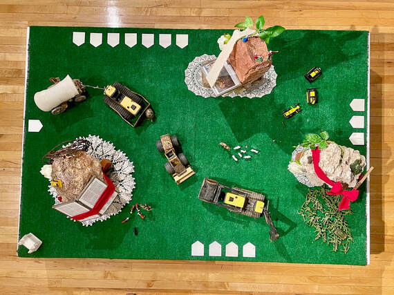
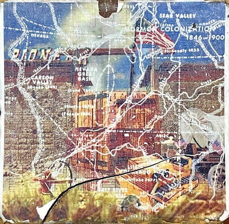
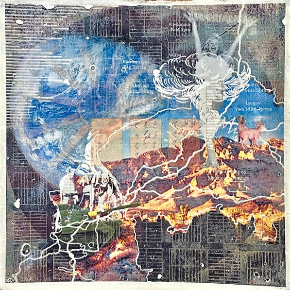
>>> tap the images to view the sections <<<
